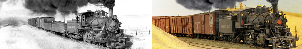
A Virtual Tour of the YV using Bing and Google Maps
GOOGLE AND BING AERIAL MAPS provide a way to have a “virtual” tour of the Yosemite Valley Railroad. While I prefer Google maps, Bing maps have newer photography of portions of the route where the Yosemite Valley Railroad once operated.
To follow this virtual tour, click on each hyperlink which will take you to a specific location on the railroad. To zoom in and out, use the roller wheel on your mouse. Otherwise, use the “+/-“ tool on the screen to zoom in and out. The specific location or item being discussed is always centered on the aerial view. If you need to recenter the map, hold down the left mouse button and just drag the view in the direction wanted. To remove the labels or road names, hover the mouse arrow over the down arrow to the right of the “Bird’s eye” menu item until it changes to an information box and then remove the check mark for “show labels”.
Depending on the size of your computer monitor, you might need to scroll out or left/right/up/down to see all of the features being discussed.
Merced to Snelling
The YV interchanged with the Southern Pacific Railroad in Merced and picked up Pullmans destined for El Portal in front of the SP station on 16th Street. The single-track mainline is the ex-Southern Pacific Railroad mainline, now the Union Pacific Railroad mainline. The SP station is the long brick building running along the tracks; one side faces the railroad tracks while the other side faces 16th Street. The automobiles angle-parked next to the station are on top of what was once the track that the YV used even though these particular tracks were owned by the SP. (For reference, Los Angeles is to the bottom right of the view and connections to San Francisco on to the upper left.) The building to the left of the SP station is a relatively new intermodal building and was not there when the YV was in operation.
Scroll out a little to see the surrounding area. The current-day aerial map below shows the SP track arrangement circa 1939 with green lines and the YV tracks with yellow lines. The tracks the YV used ran westerly from the SP station (green in the bottom right corner) and then connected to YV's own track. The YV track then swung over to the west curb line of 16th Street which was Highway 99 at the time. The first cross-street, O Street, didn’t extend westerly of 16th Street when the YV was in operation. As the tracks neared R Street (the next cross-street which crosses over the SP railroad tracks), they turned right and crossed 16th Street on an angle. The tracks then crossed a vacant field at the northeast corner of 16th Street and R Street (now the parking lot for a Walgreens store). The tracks continued across R Street and then Main Street. The YV station is in the upper left corner in yellow.
The YV also had a spur which crossed 16th Street between N Street and O Street to serve two ice houses as shown on the aerial map below. The ice houses (Merced Ice and Cold Storage Co. and Fresno Consumer's Ice Company) were in the general area now occupied by the Bank of America.

The Merced YV station was on R Street just past Main Street directly opposite the alley between Main Street and 18th Street. A shopping center now occupies that general location. At the time of this aerial mapping, a Hollywood Video store was located about where the YV was at one time.

Zoom out enough to show John C. Fremont Charter School which is on the west side of R Street between 20th and 22nd Streets. The YV yards and other buildings ran along R Street from the station to 22nd Street. The roundhouse and turntable were in the area now occupied by the school as shown in the current-day aerial map below.


The YV mainline continued north and parallel to R Street (which ended at 23rd Street when the YV was operating) then crossed the Atchison, Topeka and Santa Fe Railway (now BNSF) tracks. The crossing was controlled by an interlocking tower in the northwestern quadrant of the crossing. The street crossing the tracks here is R Street.

Nothing remains to show where this tower building once existed. The YV also interchanged freight cars with the AT&SF by backing down an interchange track to the AT&SF station which still exists today as an Amtrak station on West 24th Street. Those tracks are gone now but were on the other side of the track from the Amtrak station.
Back to following the YV, the YV continued north from the crossing with the AT&SF, crossed Bear Creek, and then crossed Black Rascal Creek in this grove of eucalyptus trees.
The concrete abutments for that bridge are still in place if you visit the location today. The YV route then passed through what is now Fahrens Park but the route beyond the park is now developed with homes. The next creek crossed by the railroad was Fahrens Creek.
The concrete bridge abutments for the railroad bridge over this creek are also still in place and are now used to support a bicycle bridge. Zoom out slightly. The YV tracks continued nearly due north from the bridge toward Bellevue Road. The dirt road shown on the current aerial map is approximately where the railroad tracks once existed. There is a relatively new housing development over part of the route between the creek and Bellevue Road. If you zoom out enough and hold the left mouse button and "pull" the view down until Bellevue Road is visible at the top of the screen, you can see a ranch road which continues all of the way to Bellevue Road and beyond. That dirt road follows what was the YV roadbed.
When the YV was in operation, a spur or side track turned left (west) from the mainline just beyond the grove of eucalyptus trees surrounding Fahrens Creek. The track made a 90 degree turn to run due west. It was just about where Pacific Drive now exists and provided rail access to the Yosemite Portland Cement Company. That plant was at the northeast corner of West Yosemite Avenue and Highway 59.
The Yosemite Portland Cement Company closed in June 1944 and the loss of that freight business resulted in the railroad being shut down the following year. Nearly all of this large plant has been demolished. But look closely next to the rear yard fences of the homes which face La Sierra Street. On the south/YPC Co. side of that fence, you can see a slight change in the color of the grass…that was the location of the railroad track coming from the mainline near Fahrens Creek. The track turned 90 degrees again (around the electrical transmission tower) toward the stack of cargo containers. The packing house and sack house were in this general area. That track was removed as part of the cleanup of the property a few years ago and was the last remnant of YV track.

Back to Fahrens Creek, the railroad continued due north to cross Bellevue Road.
Note the dirt roads leading south and north from the location of the grade crossing in the center of the aerial map. They are both former YV railroad roadbeds. Zoom out some and hold down the left mouse button and “pull” the screen down to move north along this roadbed/dirt road. It continues in a straight line for about 3 miles before turning to the west/left and disappearing into the Merced County Regional Waste Management Authority landfill property.
The railroad continued turning to the west/left and came out here.
Highway 59 comes in from the bottom of the screen and turns so that both the railroad roadbed and highway begin running parallel. They will continue to be directly adjacent to each other until near the crossing Merced River about 4-1/2 miles to the north. In some places, the roadbed is being used by the property owner as a road while, in other places, crops are being grown on what was once railroad grade.
The next creek crossed by the YV was Edendale Creek.
Bing maps doesn’t yet have Street Views but Google Maps does. Click on this link to Edendale Creek to see this location using Google Street Views. (Loading this and other Street View links might take 10-15 seconds or more depending on the speed of your Internet connection.) The rubble and concrete wingwall visible were added probably when the highway bridge was rebuilt. But the abutments (the large concrete structures just visible on each side of the creek) are still in place. The wood trestle here rested on these abutments. To look around, point the mouse arrow at the N in the compass in the upper left corner of the view, hold down the left mouse button, and rotate the compass.
The next bridge on the YV crossed one channel of Canal Creek. There is a weir on the Main Canal which regulates water flow from the Main Canal into Canal Creek. The old, original highway bridge still exists to the west/left of the current highway bridge. The current highway bridge was built right where the YV railroad bridge was once located.
The YV tracks and Highway 59 continue to parallel each other (the railroad was built before the highway was built). The next creek crossing was on the main channel of Canal Creek. The piers for the long railroad trestle which crossed the creek are obvious to the east or right of Highway 59. Click on this Google link to see the piers using Google Street View.
The highway continues to follow the railroad tracks for the next mile or so to where the railroad crossed the Merced River. However, construction of a new highway bridge over the Merced River together with the Merced River Corridor Restoration Plan have obliterated any trace of the railroad piers which once supported the pair of steel railroad bridges over the Merced River just east of the highway bridge.

From here, the railroad turned away from the highway and the route has long been obliterated by farming activities. By zooming out quite a bit, you can see all of the area around this river crossing. Note that the highway crosses the Merced River and then turns to the right slightly to run due north before turning right to run generally northeast. It then turns through a broad curve to the left. It is at the end of this curve that the highway begins running parallel to the YV again.
In the 1946 aerial map below, the YV tracks are shown in black and overlaid onto the aerial map. There was a siding here which served a stock corral which was located between the siding and the highway.

This next photo was taken just north of this dirt farm road.

The tracks and the highway continued to run next to each other for the next mile or so. The highway originally made a sharp right turn and crossed the railroad tracks as shown on the 1915 USGS map below. Sometime in the late 1950s or early 1960s, Highway 59 was realigned by the introduction of a broad curve to eliminate the original sharp angle.

The original road was more or less left in place to provide access to the adjacent ranch. The original grade crossing was about where the white fence disappears under the trees. The "road" along this fence was the original alignment of the highway. The ranch road continuing northeasterly from this point (visible once it leaves the trees) is following the railroad road bed. (The Then and Now web page has a pair of photos taken at this grade crossing.)
Zoom out some and you can see a short detour about a quarter mile from the locked gate at the fence. This detour bypasses the location of a railroad bridge which is now gone except for the concrete abutments. Beyond this detour, the ranch road again follows the YV roadbed, making a very broad curve to the right further into the property before disappearing at a thick grove of trees. It reappears beyond the ranch where it is again being used as a dirt farm road which continues to Montgomery Street where the YV had a grade crossing.
The Snelling station was just a little further east at the end of 3rd Street. The station itself would have been on the north (far) side of the gravel road between the house (next to the tractor/trailer rig) and the metal building and across this gravel road from the single tree in the plowed field. However, there is no evidence of the former station site or tracks on the property.

Zoom out somewhat and you can see a line of trees to the east of the Snelling station site which marks the alignment of the railroad. It is along the northerly border of the Snelling-Merced Falls Elementary School.
Snelling to Bagby
The railroad route is difficult to follow for the next few miles but becomes obvious again east of Henderson Park where a portion of it is used as a private dirt airstrip.
East of the airstrip, the alignment can easily be seen by zooming out a little. It is very obvious where the railroad crossed the dirt road to Kelsey Reservoir...it was just north and adjacent to the small pond east/right of the dirt road. There was a railroad siding here to serve the Kelsey Ranch. Further east another dirt road first follows a canal before turning right to cross it where it then begins following the railroad roadbed before turning north just before Merced Falls.
Little is left of the town of Merced Falls. After the Yosemite Sugar Pine Lumber Company shut down in the 1942, the lumber mill was dismantled along with the entire town. However, decades later, many of the foundations and evidence of buildings still remain visible in aerial maps even though a property owner removed a lot of the remains in the vicinity of the planing mill in 2013.
There was once an entire town here including homes, a store, ice plant, and school as well as the entire lumber mill and lumber planing operations.

The railroad crossed Merced Falls Road after the left turn upon arriving in Merced Falls. When the lumber company was operational, the manager lived in a two-story home in inside of this curve as shown in the photos below.

Although the current owner of the property bulldozed the steps and retaining wall around the foundation of this home in 2013, Google Street Views still shows how things were for decades earlier. This Google link takes you to the street in front of the former home. The curve where the boy was pedaling his bike in the above photo is to the left. It would have been a nice place to live...walk across the street and you are at the office! Of course, no one who lived in Merced Falls had very far to walk to work each day.
The aerial photo below shows some of the remains which are still visible in the above "crossed Merced Falls Road" link.


The railroad tracks continued past the YV station in Merced Falls and then crossed Hornitos Road on an angle. Visible on the west/left are a pair of abutments for a double-track bridge over a dry gulch. The aerial below shows the alignment of the railroad from this bridge to east of Hornitos Road.

In the early 1920s, the Merced Irrigation District (MID) decided to build a dam on the Merced River about 7 miles upstream of Merced Falls. The original YV track closely followed the Merced River which meant that the MID would be required to construct about 17 miles of new YV tracks to get the railroad around and above the planned dam. The relocation extended from Merced Falls to Detwiler at the east end of the planned reservoir.
The relocated route crossed an unnamed creek surrounded by trees in the above view on a concrete arch culvert. Click this Google Link to see this culvert using Google Street Views. The culvert is in the shadows but very obvious.
When the YV was operating, the Hornitos Road ran from Merced Falls to the bridge over the Merced River where it turned and continued to Hornitos. The current road beyond this bridge follows the relocated YV route. So, drivers on this road are driving on the relocated YV roadbed beginning here just east of the bridge to Hornitos. The current road continues to here where the YV tracks continued straight (in front of the white pickup) while the road turns slightly to the left.
Zoom out slightly and you can see a dirt road on the upstream side of McSwain Dam. That dirt road is also the YV roadbed. That dirt road disappears in a current-day parking lot. But pan to the east (right) and you will see a paved road serving a parking lot next to the boat ramp for Lake McSwain and RV campgrounds to both sides of the road. That road follows the YV route until it meets up with the Lake McClure Road.
Lake McClure Road then continues to follow the YV route for about 2-1/2 miles until it reaches the location of a 180-foot-long steel trestle over an unnamed gully. Today, the road curves around this bridge location but the concrete abutments for the bridge are still there today.

Zoom out and pan upward and you can continue to follow the YV roadbed/Lake McClure Road to the location of Starr. At this point, the Lake McClure Road drops down toward the bottom of the Exchequer Dam while the railroad roadbed continues on the same grade. Starr was the location of a passing siding. The road leaves the YV route at this point and drops downgrade toward the original Exchequer Dam.
Beyond Starr, the railroad crossed a large wood trestle. This view looks west and the piers for this trestle are readily visible. The tracks then entered the west portal of Tunnel 1, this view looks north toward the tunnel portal.
(Directions on the YV were either west or east, regardless of the actual compass direction. Any train running toward El Portal was thus eastbound and any train running toward Merced was westbound. At this point along the route, the tracks were running north/south. But the tunnel portal here is the west portal since it on the side closest to Merced. Generally, in this narrative and on the Tracing the YV web page, compass directions are used. But here I need to maintain YV east/west designations.)
The tunnel is about 550 feet long. This view of the east portal of the same tunnel looks south. The roadbed here is very visible and was, for a long time, a dirt road that allowed one to drive to this tunnel portal and through the tunnel if desired. However, a rock slide (and a gate) have closed the road to the tunnel to vehicles. But you can still walk the quarter mile to the tunnel from the unnamed road linked below.
Continuing east, the roadbed crosses an unnamed road. The Lake McClure Road is the paved road to the east/right while the roadbed is curving away from this unnamed road toward the south toward Tunnel 1. The railroad route north of this road is obvious by the cut in the hillside. This unnamed road is closed by a locked gate just beyond the railroad route.
The current road comes back up to rejoin the roadbed about in the middle of this turn in the highway which it follows to this intersection. This side road follows the railroad route.
Unfortunately, this route is now closed to the public by a gate. However, we can continue to follow it "virtually" to Tunnel 2. Zoom out a little and you can see how the current road follows the railroad route before making a hard right turn to drop down to a water crossing before curving back up to follow the continuation of the railroad route. You can also see the earlier pavement leading to and from a concrete arch culvert for the railroad, clearly exposed in the creek bed below.
In the early 1960s, MID built a new, higher dam here. After the new dam was finished, there were concerns about a leak from joints in the dam's concrete face resulting from settlement. The leak was determined not to be a safety issue but an economic one since the leaking water wasn't going through the turbines to create electricity (which was sold to the power company). The leak was of the order of 300 cubic feet per second. Regardless, the State Division of Dam Safety ordered that the lake level be lowered 34 feet to the bottom of the spillway gates. To do that, a gate valve in the dam which let water flow out of the lake but bypass the turbines, was opened to its design capacity of 8,000 cubic feet per second. Preparations were also made to reinforce (somehow) the roadway culverts below the spillway, including the one near Tunnel 2, so that the spillway gates could also be opened. However, before that could take place the gate valve failed completely. The operator was able to close the inlet valve but that meant that they needed to immediately open the spillway, which washed out this YV arch culvert and the road itself.
After the current road climbs back up to the railroad roadbed, the roadbed turns off a little further up the road and continues to the west portal of Tunnel 2. Tunnel 2 originally passed above the original Exchequer Dam. But, when the new, higher dam was built in the early 1960s, this tunnel was plugged with concrete; the other end of this tunnel is therefore normally under water.
Before leaving this area, we can visit one more remnant of the YV. That would be the water tank which was once located in Merced Falls opposite the station.

After the YV was abandoned, the scrapper listed all of the water tanks for sale. This one was sold and was relocated not that far away to serve as a water supply for the employee housing near Exchequer Dam. The legs of the water tank were shorten but it is still there above the employee housing area. It is no longer being used to supply drinking water but does provide water for fire protection. Unfortunately, the public is prevented from visiting the water tank but we can see it right here. Turn off the labels to get a better view of the tank. A group of YV fans was granted access to this area in early 2014. Here is a photo of the tank today:

All of the YV route above Tunnel No 2 was flooded by the higher lake levels from the dam to east of Bagby. While the site of the town of Bagby is under water when lake levels are high, Bing's Bird's eye mapping shows the general area which was once Bagby. Much of the roadbed here has eroded and sloughed off.
Bagby to Briceburg
The flooding due to the New Exchequer Dam extends above Solomon Gulch when the lake is full. There were only four wood trestles between Bagby and North Fork which are now gone except for the concrete piers and abutments. There was a concrete retaining wall which is still in place. (The Then and Now web page has a pair of photos taken of this retaining wall.)
About a mile upstream is North Fork where the North Fork of the Merced River (on the north/left side) meets the main fork of the Merced River. There was a 125-foot-long deck truss steel bridge over the North Fork of the Merced River here. While the abutments for the bridge are still there today, they are hidden by brush in the aerial. The roadbed is obvious upstream as shown in this view site, and for the most part, easily visible downstream nearly to Bagby.
The choice of a deck truss for this bridge (where the entire bridge support structure is under the track) was unusual for the YV but was required since the track was on a curve here.

Two miles east of North Fork/Broadhear/Lehmer was the station at Mountain King (later renamed Kocher), home of the Mountain King Mine. That mine predated the construction of the railroad. The original stamp mill was next to the river while the mine itself was 300 higher and a quarter of a mile up Quartz Gulch. A new stamp mill was built at the level of the mine by 1914. The location of that stamp mill is shown by the horizontal supports below the shelf where the tram was located. The tram moved ore from the mine to the stamp mill and also supplies to the operation. The entrance to the mine is further up Quartz Gulch---follow the tram north past the light-colored dump of material excavated from the mine to the grove of trees which somewhat hide the mine entrance.
At different times, there were three inclined trams here as shown by the scars still visible. The one in the middle was used to move ore from the mine to the first stamp mill down by the river. The one closest to Quartz Gulch was used to bring supplies up to the level of the mine from the YV station below. The long inclined tram on the right was used in the late 1800s during the first prospecting cycle.

Briceburg to El Portal
(Note: Bing aerial photography from Briceburg to El Portal is lower resolution photography without bird's eye view options. Therefore, Google maps are used for the balance of the virtual tour. To turn off road labels in Google Maps, point to the box labeled Traffic and click on "Labels" to remove the checkmark.
Briceburg was another non-station location on the YV on the north side of the river. Early on, there was a store here started by William Brice (hence the name of the location). After the All-Year Highway (now Highway 140) was extended from Midpines down Bear Creek Canyon to the Merced River and on to El Portal, an automobile bridge was built from Briceburg to the new highway. There are several buildings here but it is difficult to determine if any were there when the YV was in operation. In this view, Highway 140 is the paved road on the right while the suspension bridge crosses the Merced River. The dirt road switch-backing up the mountain from the bridge is the Bull Creek Road/Briceburg Road. The dirt road west of the suspension bridge follows the YV roadbed. The YV roadbed continues easterly from this location but there is no vehicle access. The roadbed can be followed on foot all of the way to Clearinghouse.
Emory was located slightly over 6 miles east of Briceburg. It was the location of a limestone quarry which supplied crushed limestone to the Yosemite Portland Cement plant at Merced. There are a number of structures here, some from when the quarry was in operation and others built much later when several people lived here year-around. There was a double track bridge over Miller Gulch here, now replaced by a couple of planks. Just to the west of this bridge is a building with a shiny metal roof. That building was here when the quarry was in operation as well as the boarding house further west with the partially rusty roof. This boarding house was one of two here. The other was just to the west of the still-existing one but burned in April 2003; debris from that building shows where it stood.
East of Miller Gulch is a large newer building with a metal roof and, to the east of that, is a very small building sitting on an angle to the river. This building was originally positioned just east of Miller Gulch between the railroad tracks and the river. It was the YV freight house here. There is more information here on the Then and Now web page.


The quarry here was up Miller Gulch about 800 feet higher than Emory. A standard gauge inclined railway connected the quarry to a crusher located directly above Emory. The crushed limestone was lowered using a pair of hopper cars running on a 2,100-foot incline to the storage bunker at Emory and then shipped to the plant at Merced over the YV. The remains of the crusher are here; the incline down to the storage bunker is shown by the gray ballast leading away from the concrete foundations toward the bottom of the aerial. The shelf running nearly due north from the crusher was where the railroad ran which connected the quarry with the crusher. Here is a bird's eye view of the crusher area. The crusher is in the center of the view with one tree to the west of it. The incline extends down through the chaparral below it. You can also barely see the zig-zag truck road up to the crusher to the west of the incline.
The quarry was to the northeast of the crusher. This view of the area shows the crusher a little left of center (with the single tree) and the quarry at the top. It is easy to just follow the shelf where the railroad ran north from the crusher to the gully where it turns southerly and then around the nose of the mountain to the quarry. Zoom out slightly to see the extent of the quarry.


Incline was an important location on the Yosemite Valley Railroad since this was the location of another railroad incline. This incline connected the Yosemite Lumber Company logging operations north of Trumbull Peak with the YV. Loaded log cars were lowered down this 8,700-foot-long incline (which had grades up to 78%) to the YV. The loaded log cars were then taken to the lumber mill at Merced Falls.
Very little is left at Incline from the days when the incline was in operation. The route of the tracks is now a paved road. In the aerial, there is one metal-roofed building between the road and the river...that building was the logging superintendent's house. After the lumber company shut down in 1942, the house was purchased by Jim Law, a longtime resident of the El Portal/Incline area. The YV station was located to the east (compass north) along with the freight house and station agent's house. All of those structures are long gone.

The bottom of the logging incline here connected to the YV west of the logging superintendent's house. About in the middle of the curve in the road in the aerial view is a intersecting road with two legs. One road turns west toward the home with the swimming pool while the other leg turns and heads northerly. That latter road was the bottom of the incline.


The logging incline was actually very steep but the above photo makes it difficult to visualize. Here is a view which makes it easier to understand reality. The bottom of the incline is just to the right of the center of the aerial view. It is easy to follow the incline straight up through the chaparral and then along the ridge. Near the top, the incline curved around a knob and continued to just below the hoist house. The concrete foundation of the hoist house is right on the ridge while the route of the incline is visible at the bottom of the view just to the right of center. Follow the incline up toward the curve and you can also see some of the supports for the rollers that once carried the wire rope around the curve higher up.
The paved YV roadbed continues east from Incline all of the way to El Portal. Two miles east of Incline was a wye at Moss Canyon. When the YV was in operation, this wye was used to turn entire passenger trains heading to El Portal. Upon arrival at Moss Canyon, the locomotive would be on the east end of the train. But, the entire train needed to be turned around when it headed back to Merced. It made sense to turn the entire train end-for-end on the way to El Portal and back into the station there so that the passenger cars would be next to station where they would be closer to the buses.

Today, the National Park Service has a large maintenance facility which occupies the area inside what was the wye at Moss Canyon. The YV roadbed is used now for roads in this area. Highway 140 is south/below the Merced River while the roads north of the river all follow the YV route. On the left is the route from Incline west of here. (The current Foresta bridge over the Merced River did not exist when the YV was in operation.) The YV mainline ran around the north side of the NPS facilities while the west leg of the railroad wye and the tail of the wye were along the river. (The YV mainline is used mostly for parking these days.) The Then and Now web page has a comparison the original layout of the wye here to today's view.
The ridge to the east of the wye at Moss Canyon was called Hog Back Ridge. The YV went around this ridge to another important shipper, National Lead Company. Although “glory holes” up the hill would lead one to believe that the National Lead Company mine was above the road here, the mine was actually on the south side of the river and was connected to the plant by an aerial tram.

The eastern terminus of the Yosemite Valley Railroad was El Portal. The layout of the yards here is shown below.

In recent years, the Yosemite Fund has provided funding for restoration of a Hetch-Hetchy Railroad Shay logging locomotive and YV caboose 15 on display in El Portal. The have also funded the rebuilding of the turntable in the original turntable pit. The new turntable is across the road from the dirt parking lot near the center of the aerial view. The Shay locomotive is on the stub track from the turntable closes to the road while the restored YV caboose is on the other stub track. (There weren't any stub tracks when the YV was in operation since the turntable was used only to turn equipment.) The building to the east of the turntable is the restored Bagby station, moved here before the town of Bagby was flooded by rising waters from the new Exchequer Dam. West of the turntable and partially hidden by a tree is the restored the Bagby water tank.
Between 1911 and 1923, there was a logging incline at El Portal which was used to access timber in the Yosemite West area and beyond. (It was moved to Incline during the winter of 1923-1924 after timber was exhausted south of the river.) Tracks connected to the El Portal yards via a wye and inclined bridge over the Merced River:

All evidence of the location of this bridge was hidden by brush until the January 1997 Merced River flood which stripped away that vegetation. That bridge pier is now easily visible in the middle of the river here. Highway 140 runs parallel to the river while the El Portal Road which leads to the restored turntable is on the left. You can see the concrete pier right in the center of the aerial view. Another concrete pier is visible on the south side of the river in line with the one in the middle of the river. The building at the top of the aerial is the El Portal Market which burned after the date of this aerial photography.