Tracing the YVRR Today
UNFORTUNATELY, THERE ISN'T MUCH LEFT OF THE Yosemite Valley Railroad today. However, much of the YV roadbed is still visible and some of it can be driven in a regular passenger car.
There are very few visible remains of the YV in Merced but it is still interesting to trace where it once ran. To follow the route, start at the Southern Pacific Railroad Station on 16th Street at N Street. The YV tracks were directly in front of the station (the side with the railroad tracks); this area is now paved and used for parking. From the SP station, the YV tracks swung northerly next to the curb line of 16th Street and then crossed 16th Street between Q Street and R Street. They then bisected a vacant field at the corner of 16th Street and R Street where a Walgreens Drugs now exists. The YV also had a spur which crossed 16th Street between N Street and O Street to serve two ice houses. The ice houses (Merced Ice and Cold Storage Co. and Fresno Consumer's Ice Company) were in the general area now occupied by the Bank of America.

Once on the west side of R Street, the YV tracks crossed Main Street (a dirt road in those days) and came alongside the west side of the YV Merced station and general offices.

The station was located on the west side of R Street just north of Main Street. The station was directly across from the alley between Main Street and 18th Street. A shopping center now occupies this area.

Continue north on R Street. The railroad yards extended along R Street from Main Street to 22nd Street. When the YV was in operation, neither 18th Street nor 19th Street extended west of R Street. John C. Fremont Carter School is now where the roundhouse and shops were once located.


From the station, the mainline followed R Street and then crossed the Atchison, Topeka & Santa Fe Railroad (AT&SF) tracks with a 90-degree diamond which allowed the tracks to cross each other. That diamond would have been just west of the current R Street grade crossing. (When the railroad was in operation, R Street only existed as far as 23rd Street.) An interlocking tower, which controlled signals on the YV and AT&SF approaches to the crossing, was located in the northerly quadrant of this crossing. The YV also interchanged with the AT&SF via a track in the easterly quadrant of the crossing.

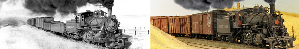
Once past the AT&SF tower, the tracks crossed Bear Creek just west of the current R Street highway bridge as shown in the above photo. From Bear Creek, the tracks continued north, bisecting the eucalyptus grove just beyond the Merced Mall shopping center. If you stay on R Street past Santa Fe Drive/West Olive Avenue and continue pass Loughborough Drive, you can see bridge abutments for Black Rascal Creek in the eucalyptus grove a few yards west of the road just before you get to Fahrens Park.

Continue north on R Street and turn left onto West Yosemite Avenue. As you complete your turn, look to your right toward another eucalyptus grove. The YV crossed Fahrens Creek in this grove of trees on a short trestle. Today, the abutments for that bridge are being used for a bike bridge. You can park in the adjacent parking lot and walk out to this bridge.
When you reach Highway 59, the site of the Yosemite Portland Cement Company plant is on your right. A spur from the YV entered the plant from the east, while an AT&SF spur served the plant from the south. Most of that plant is now gone.

From West Yosemite Avenue, turn right on Highway 59 toward Snelling. Continuing north along Highway 59, the YV mainline is running parallel to Highway 59 to the east. If you turn right onto Bellevue Road, you will cross the old right-of-way approximately 3/4 mile east of Highway 59. The old roadbed is being used as a road by ranchers both north and south of Bellevue Road and is very obvious. A housing development has erased a portion of the old roadbed between Bellevue Road and the eucalyptus grove surrounding Fahrens Creek to the south.
Returning to Highway 59, continue north toward Snelling. The obvious railroad roadbed on the west (left) side of the highway is the old Oakdale branch of the Southern Pacific Railroad. Approximately 3-1/4 miles north of Bellevue Road, begin watching for the old YV right-of-way coming in from the east (right) to parallel the highway for the next several miles.
Stay right toward Snelling on Highway 59 at the turnoff to Oakdale. Approximately a 1.2 miles past that intersection is Edendale Creek. The old YV bridge over this creek was still in place until finally being removed in the late 1990s or early 2000s although the abutments are still in place.
Approximately 1.2 miles north of Edendale is Canal Creek. The original highway bridge over this creek is to the west. The new highway bridge is right where the original railroad bridge was located.

About a half mile north of Canal Creek is another arm of Canal Creek. A fairly large wood trestle crossed this creek. The piers which supported the bridge are very obvious in the creek on the right side of the highway.
Highway 59 continues to follow the railroad to its crossing of the Merced River near MP (milepost) 13. Until around 2003 or so, the support piers for the pair of steel railroad bridges over the river were visible just northeast of the highway bridge but they are now gone as the result of the Merced River Corridor Restoration Plan. See the Then and Now web page.

From here, the railroad right-of-way moved away from the highway and the route has been obliterated by farming activities. If you reset your odometer while crossing the highway bridge over the Merced River, watch for a farm road on your right just short of 3 miles from the Merced River bridge near the start of a curve to the left. At that point, the railroad roadbed would have crossed this dirt farm road and then continued north, with the highway running parallel and to the west/left of the railroad. The roadbed would have been just on the other side of the highway fence but farming has eliminated any sign of the roadbed or embankment which once existed here.
As you pass a dirt road on the right to a gravel quarry/rock operation, look northerly along the highway. As the highway turns to the right, notice the white, private gate and overhead sign for the Oxbow Ranch in the distance. While the highway now turns to the east or right through a wide curve, both the highway and the railroad roadbed continued straight in the past.

The pavement for the old highway still exists. See the Then and Now web page for a photo of the original highway grade crossing and how it looks today. The railroad roadbed is now the private road beyond this gate. After passing this gate, the old railroad route will eventually turn easterly to cross Montgomery Road and reach the Snelling station further east.
To get to the former location of the Snelling station, turn left from Highway 59 onto Third Street in Snelling and drive to the end of the street one block north of Emma Street. A home and some outbuildings now occupy the site.

After visiting the station site, retrace your route and turn left on Highway 59 toward Merced Falls. East of Snelling, the right-of-way continues straight and nearly touches the Merced Falls Road at La Grange Road. Continue on the Merced Falls Road (County Road J16) east toward Merced Falls. Once past Henderson Park (east of Snelling), glimpses of the roadbed can be spotted approximately 400 yards north of the highway.
Continue east on County Road J16 until you reach the site of Merced Falls. The Yosemite Lumber Company/Yosemite Sugar Pine Lumber Company lumber mill, drying yards, and planing mill were here. However, the foundations of the large lumber mill along the river are just about all that is left. Unfortunately, they are now posted "No Trespassing".
The track spur to the log dump would have passed directly through the sharp curve to the left as you enter Merced Falls.


The YV main tracks crossed the Merced Falls Road just before the road reaches the intersection with Hornitos Road. The area west of the Merced Falls Road and northerly of the tracks was filled with the box factory and loading shed while the hill behind them was covered with lumber drying yards. Turn left on Hornitos Road toward Lake McClure. The area north of the Hornitos Road was housing for the workers and their families.

The station was about 100 yards east of Merced Falls Road.

Turn left and follow the Hornitos Road toward Lake McClure. As the road gets closer to the Merced River and just before the bridge over the Merced River, watch for a concrete bridge/culvert under the roadway. If there are no cars behind you, slow as you are directly on the bridge and look to the left to see a concrete arch culvert which supported the railroad tracks over this waterway. It was built as part of the railroad relocation work associated with the construction of the Exchequer Dam; see the History web page for more information.
When the railroad was in operation, the Hornitos Road turned and crossed the bridge over the river and did not extend east of the bridge. Continue straight onto Lake McClure Road. Shortly after passing the turn toward the bridge over the Merced River, you will begin driving right where the tracks were 60+ years ago.

Continue east on Lake McClure Road. The road leaves the YV route just before the road reaches the McSwain Dam and the entrance station. After passing the pay station, there will be an intersection with a paved road on the right about 0.7 miles beyond the pay station. That paved side road was the YV roadbed. Once past this intersection, you will again be driving on the YV route nearly to the New Exchequer Dam.
This portion of the YV was rebuilt in the mid-1920s to allow for construction of the Exchequer Dam. As the road continues toward Lake McClure on a 1-1/2% grade, watch for the abutments of Bridge 29A about 3 miles from the entrance station. The 260-foot-long plate girder steel bridge was constructed as part of the track relocation work. The road jogs around the gully but the abutments are still in place and very obvious. Continue around the gully and pull over off the shoulder to view the location of this bridge.

Back on the road, continue north. When you crest a hill and see the dam itself as the road drops down, watch on your left. The railroad grade continues at the same general elevation while the road heads down to the entrance to the employee housing at the base of the dam. Look along the roadbed and you can see Tunnel 1 in the distance.

As you start down the road toward the turnoff to the employee housing, look up a gully halfway down the hill for a view of the footings of a large YV wood trestle.

After passing the turnoff to the original dam site, the road will climb back up to the railroad route. There is an unnamed, semi-paved road on the left (the first road you will come to as you drive back uphill). If you turn left here and park before the gate (but don't block it), you can walk about a quarter mile west to the east portal of Tunnel 1. The roadbed is obvious and has a wire rope across it to keep out vehicles. You can also walk through the tunnel if you want.

Continuing on the paved main road, the road will reconnect with the YV route a short distance before a road comes in from the right. That road on the right was the YV route to Tunnel 2 but a locked gate controls access. This is the end of the visible right-of-way until Bagby further up river.
Tunnels 3 and 4 are further northeast but under the surface of Lake McClure most of the time. When the water levels drop in the fall, it is sometimes possible to walk to them. (When the railroad was in operation, the normal lake level was at elevation 707 feet. The tracks were about 40 feet above the high lake level so access to the tunnels is cut off when the lake level reaches about elevation 750 feet.
To reach the tunnels when water levels are low enough, continue east toward McClure Point Recreational Area and drive down the hill to the boat ramp. If the water level is low enough, the roadbed for the railroad will be visible and you can walk to Tunnel 3 which will be to the left and visible from the roadway down to the boat ramp. If you walk through Tunnel 3, you can reach Tunnel 4 close by.
During the last California drought, it was possible to drive to the Barrett Cove Recreation Area and see portions of the right-of-way near the old Barrett station. However, these areas are also typically under water.
After passing the Barrett station, the railroad crossed over Lake McClure on a 1600-foot-long bridge and then followed along the south side of the lake. The tracks then crossed Merced River about 10 miles upstream of the lake.
To continue to follow the YV, backtrack to Merced Falls and either:
-
Just before reaching Merced Falls, turn left onto the bridge over the Merced River to Hornitos. Take the left fork in Hornitos onto Bear Valley Road which will take you to Highway 49. Then turn left onto Highway 49 to Bagby. (Based on Google maps, this option is 22 miles, 40 minutes)
-
Once in Merced Falls, turn right onto Merced Falls Road and follow it to Highway 132. Turn right on Highway 132 toward Coulterville. Once in Coulterville, turn right on Highway 49 to Bagby. (Based on Google maps, this option is 33 miles, 52 minutes.)
Bagby was an early town dating back to 1900 or so. However, the town of Bagby was flooded when the original Exchequer Dam was replaced with a taller, rock-filled dam in the early 1960s. Bagby is now completely gone except for some foundations easily visible from the new Highway 49 bridge over the Merced River when lake water levels are below 800 feet elevation. When the area is out of the water, you can park north of the river (space is available on the west side of Highway 49), cross the highway and hike down to the former town site. (Some historic photos of Bagby are available online here.)


The remains of the Bagby railroad bridge located downstream/west from Bagby (see the Then and Now web page) are visible during low water times from the shoulder of Highway 49 just north of the highway bridge. The railroad bridge was removed back in the 1960s and only some of the steel piers remain.
It would seem that you should be able to hike the old railroad roadbed upstream from Bagby to North Fork. However, the roadbed has slipped out just upstream of Bagby and it is not possible to get around this slip-out unless you have a boat to get upstream of the slip-out or you plan your trip when the water level of the lake is low enough. If you can get around the slip-out, you can easily hike all of the way to Briceburg by following the railroad roadbed if water levels on the North Fork of the Merced River are low enough. The actual distance from Bagby to Briceburg is 13.1 miles, based on YV timetables.
To continue our tour, you need to head south on Highway 49 to Mariposa. In Mariposa, turn left onto Highway 140 toward Midpines and Yosemite. Continue past Midpines northerly on Highway 140 and down the Bear Creek grade to the Merced River. Briceburg is at the bottom of this grade.

Upon reaching Briceburg, you can cross the Merced River on the suspension bridge from the road which intersects Highway 140 just beyond of the old gas station which is now a BLM museum. Once across the river, turn left and drive the YV roadbed for approximately 6 miles downstream. A nice campground is located at Railroad Flat which was actually the site of the passing siding at Harte on the YV. You can easily hike downstream from Harte on the old roadbed to North Fork. If the North Fork of the Merced River is low, you can continue hiking down river nearly to Bagby (a slip-out will keep you from reaching the site of Bagby itself). Because of rocks and damage to the roadbed, mountain-biking this section of roadbed would be difficult.
Back at Briceburg, you can hike upstream for a couple hundred yards to the site of one of the larger wood trestles on this section of railroad although the only thing still existing there are the bridge piers and abutments.
Back on Highway 140 and turning upstream, you will now parallel the YV roadbed the rest of the way to El Portal. It is easy to follow the roadbed on the opposite side of the river. The piers and abutments of a number of bridges are also still in place. About 4.8 miles from Briceburg, the highway, which was headed northeast, will turn slightly to the left and head due north. While the change in direction may be subtle, the vegetation on the hillside across the river will change relatively dramatically from open grassy areas with trees along the river and the roadbed to chaparral which is characterized by dense, low, nearly impenetrable, thickets of shrubs. This hillside is known as Jenkins Hill.

Just beyond Jenkins Hill is the site of Emory. There were a number of buildings here which was the location of a large limestone quarry operation. However, all of the remaining structures including the last of two boarding houses for the workers were destroyed by the Ferguson Forest Fire in 2018. (The other boarding house burned in April 2003.) The location of the incline railway at Emory is very visible, climbing the steep hillside above Miller Gulch. The crusher was located at the top of the incline along with the hoisting machinery while the quarry was located east of the crusher. Both locations are visible from the highway. The incline railway here was 2,100 feet long. Loaded hopper cars were lowered down this incline and the crushed limestone stored in a large storage bunker.


The freight house still exists today although it has been moved and is hidden from the highway. More information on this structure is on the web page on Remaining YV Buildings and Equipment.
The Ferguson Slide has closed a portion of Highway 140 east of Emory. To get around the slide, traffic is diverted to the north side of the Merced River and then back again. The detour uses a short stretch of former YV roadbed to bypass this slide. (Vehicles longer than 45' are prohibited from using these bridges.)
Further up the road, you can see the 8700-foot-long logging incline at Incline opposite Cedar Lodge near Indian Flat. Pull over and look north across the river. The major peak is Trumbull Peak and the logging incline hoist house was near the top of this peak. If you look carefully, you can easily make out the remains of the concrete foundation for the hoist house just below the peak as well as the incline track roadbed. Tracks ran from the hoist house around the east side of the small peak and then directly down to Incline on the opposite side of the river.


Continuing east on Highway 140 but before reaching El Portal, turn left across the Foresta Bridge onto Foresta Road. On the north side of the river, you can turn west (left) and follow the current road to Incline. This road was built on the old roadbed.
The Moss Canyon water tank was located just before crossing the first bridge on the road. Look for the footings located on the cut along the north (right) side of the roadbed just before crossing the bridge.

You can drive the YV roadbed to Incline, two miles downriver, and then continue about 1-1/2 miles further down river to the site of the Clearinghouse Mine if desired. The public road is closed beyond that point.
While all railroad buildings are gone from Incline, the area is still interesting with some evidence of the past logging operations including a few ties still in the ground near the old fuel reload spur. The logging incline foreman's house still exists to the west of the station site while the station site itself was at one time marked with a sign in the orchard. The orchard may be gone now. The Then and Now web page has a photo comparison at Incline which can help locate the station location.


Returning back to the Foresta Bridge, continue east on Foresta Road rather than recross the bridge to Highway 140. The YV had a wye located in the area now occupied by the Yosemite National Park sanitation and maintenance plant. The road you are now on was the tail of the wye while the mainline followed the base of the ridge and is closed. (See the Then and Now web page for a drawing of how a wye was used to turn trains.) This wye was used to turn passenger trains which were then backed the remaining 2.5 miles to El Portal.
At the end of the wye, the road climbs up onto the old mainline grade which it then follows into El Portal. The curve around this first ridge line is Hogback Bend, the sharpest curve on the railroad (18 degrees). Beyond Hogback Bend are some new housing units built by the Park Service. Those buildings are near what was once National Lead Company, an important shipper on the railroad. Although “glory holes” up the hill would lead one to believe that the National Lead Company mine was above the road here, the mine was actually on the south side of the river and was connected to the plant by an aerial tram.

As you continue on this road, you are driving on the YV roadbed toward El Portal. As you reach El Portal, you'll see the restored Bagby water tank (although the legs of the water tank have been shortened) on the left and the Bagby station in front of you. There was also a water plug at Bagby and the pipe from that water plug is on display next to the tank. All three of these items were relocated from Bagby before the town was flooded when the New Exchequer Dam was built in the early 1960s.
In recent years, the Yosemite Fund has provided funding for restoration of the Hetch-Hetchy Railroad Shay and YV caboose No. 15 which are on display in El Portal. The have also funded the rebuilding of the turntable in the original turntable pit. The turntable restoration project used metal parts from the Bagby turntable which was also relocated from Bagby with the station and water tank. But it was too dilapidated to restore so the metal parts were used on a new, authentic reproduction of the original El Portal turntable.
The YV mainline passed the current site of the Post Office (when the YV was in service, the Government Warehouse was where the current by the Post Office is now located) and some other buildings. The yards filled the area from the Post Office to the gas station to the east.


Opposite the community building are three small houses. These were once railroad cottages owned by the YV. They have been extensively remodeled over the years by their owners.

Park and walk west past the metal fire department building. The road seems to deadend but you can walk to the right to get around a fenced storage shelter. Back in the 1960s, this was a transportation exhibit with examples of trucks and automobiles used in the Park over the years and was open to the public. It has been closed to the public now for decades and has deteriorated into a simple storage area. If you walk around the enclosure to the back corner of the east end, you can see a YV speeder (minus the engine) donated to the NPS by Al Rose and Stanley Snook.
The El Portal depot, which burned in 1949, was located about where this storage shelter is today but extended further to the west since it was about 150 feet long.

The train shed was behind the area occupied by the gas station today. There is a concrete slab here. This slab was next to the train shed and the curb on the river side of the slab still has some C channels attached to it which supported the posts of the train shed. Buses parked on this slab while waiting for passengers to disembark from their trains, climb on board the buses, and depart for Yosemite Valley.

